


KARTA, handkolorerad etsning, John Senex, England ca 1720.
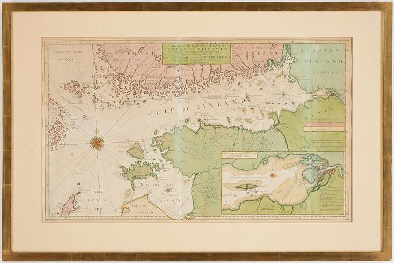

KARTA, handkolorerad etsning, John Senex, England ca 1720.
"A Map or Chart of the Gulfs of Finland and Livonia with their respective ports and harbours together with a large plan of Kroonstad and St. Petersburg". Plåtstorlek 40,5 x 68.
Ej examinerad ur ram. Gulnad. Veck. Fläckar.
Muiden katsomia kohteita
5p 10 h
Salvator Rosa, 'Apollo and the Cumaean Sibyl', ca 1651.
Ei tarjouksia
Lähtöhinta 3 000 SEK
1p 15 h
Santeri Salokivi, Satamamarkkinat.
Ei tarjouksia
Lähtöhinta 250 EUR
6p 14 h
Arman, Arman, "Blue Variations" (Untitled).
Ei tarjouksia
Lähtöhinta 4 000 SEK
5p 15 h
André Lanskoy, from "Le journal d'un fou".
Ei tarjouksia
Lähtöhinta 3 000 SEK
6p 15 h
Carl Johan De Geer, "En svensk tiger II".
Ei tarjouksia
Lähtöhinta 4 000 SEK
6p 16 h
Arman, Untitled.
Ei tarjouksia
Lähtöhinta 2 500 SEK
3p 16 h
André Lanskoy, from "Le journal d'un fou".
Ei tarjouksia
Lähtöhinta 3 000 SEK
2p 12 h
Anders Zorn, "Lavards Anders".
Ei tarjouksia
Lähtöhinta 4 000 SEK