


KARTA, handkolorerad etsning, John Senex, England ca 1720.
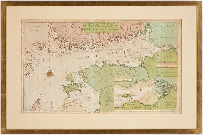

KARTA, handkolorerad etsning, John Senex, England ca 1720.
"A Map or Chart of the Gulfs of Finland and Livonia with their respective ports and harbours together with a large plan of Kroonstad and St. Petersburg". Plåtstorlek 40,5 x 68.
Ej examinerad ur ram. Gulnad. Veck. Fläckar.
Others have also viewed
5d 12h
André Lanskoy, from "Le journal d'un fou".
No bids
Estimate 3 000 SEK
6d 11h
Anders Zorn, "Sommar"".
No bids
Estimate 3 000 SEK
5d 9h
Friedensreich Hundertwasser, 'Good Morning City - Bleeding Town'.
No bids
Estimate 8 000 SEK
6d 13h
Carl Johan De Geer, "En svensk tiger II".
No bids
Estimate 4 000 SEK
3d 8h
Antoni Tàpies, Untitled.
No bids
Estimate 8 000 SEK
1d 9h
Kartor, 3 st. Kopparstick, delvis kolorerade.
No bids
Estimate 2 500 SEK
2d 12h
Antoni Tàpies, Untitled.
No bids
Estimate 8 000 SEK
6d 14h
Arman, Untitled.
No bids
Estimate 2 500 SEK