


KARTA, "La Topografia di Roma". 1700-tal.
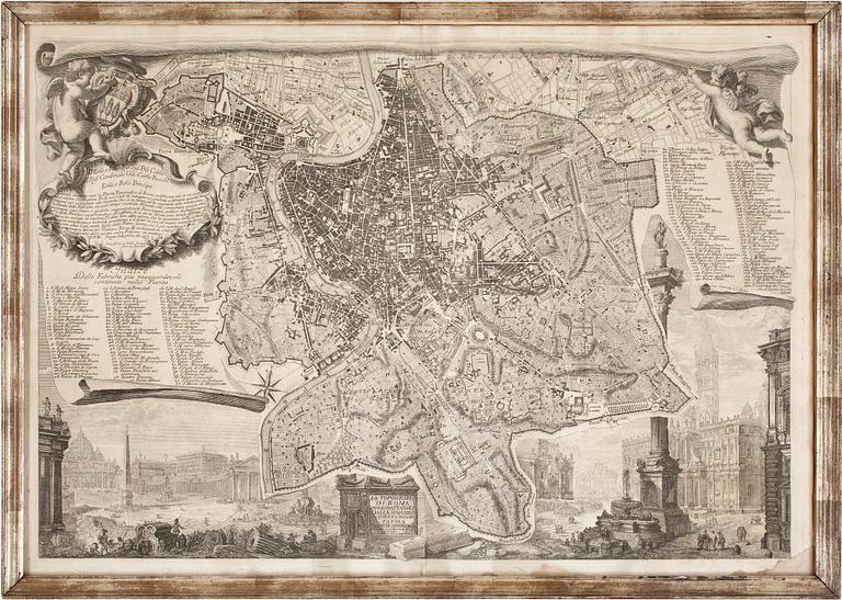
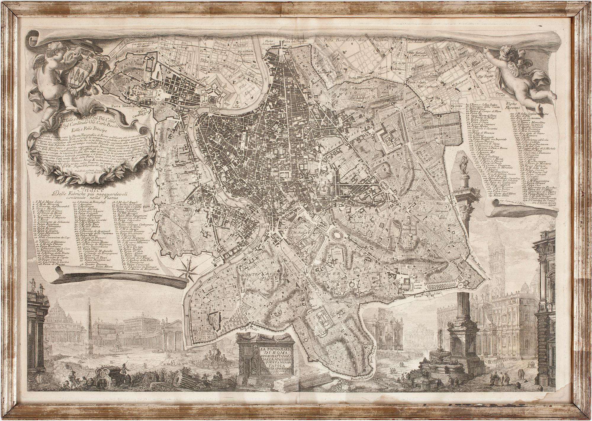
KARTA, "La Topografia di Roma". 1700-tal.
Stadsplan över Rom. 69 x 48.
Gulnad, veck, fläckar, obetydligt hål, ej examinerad ur ram.
Others have also viewed
3d 1h
Arman, "Allegro Vivaldi".
No bids
Estimate 3 000 SEK
1h 42m
C Göran Karlsson, "Rendez-Vous".
No bids
Estimate 2 500 SEK
6d 23h
Victor Vasarely, "Flower Girl".
No bids
Estimate 4 000 SEK
6d 23h
Anders Zorn, "Ernest Renan".
No bids
Estimate 5 000 SEK
7d 3h
Olle Bærtling, "Yuak".
No bids
Estimate 15 000 SEK
6d
Frits Thaulow, "Inntrykk fra sne / Effet de neige".
No bids
Estimate 4 000 SEK
3d 3h
Jarl Ingvarsson, "A Cup of Lake".
No bids
Estimate 3 000 SEK
7d 3h
Yrjö Edelmann, Composition.
No bids
Estimate 2 500 SEK